The admiral spread the map across the table in 1513. Drawn on gazelle skin, it showed coastlines no European was supposed to know. Along the bottom edge sat a southern land — and centuries later, people would swear its curves matched a continent that is today buried under two miles of ice. A continent no one should have been able to map at all. Because when the ice is there, there is nothing left to draw.

Quick Facts
| Fact | Details |
|---|---|
| Legend | Atlantis |
| Earliest source | Plato’s Timaeus and Critias (~360 BC) |
| The map | Piri Reis Map, 1513 |
| Proposed location | Antarctica (alternative theories only) |
| Proposed mechanism | Earth Crust Displacement / “pole shift” (Charles Hapgood) |
| Scientific consensus | No confirmed evidence; Antarctic ice is ~34 million years old |
What We Were Told
The story we learned is simple. Atlantis was a fable — a moral tale Plato invented around 360 BC to warn about pride and power. There was no lost continent, no advanced civilization swallowed by the sea. And Antarctica? A frozen wasteland at the bottom of the world, locked in ice for millions of years, never home to anyone.
For most historians and geologists, that remains the answer. Atlantis is philosophy, not geography. Antarctica is, and long was, ice.

What Was Found
Then there is the Piri Reis map. Compiled in 1513 by an Ottoman admiral from older source charts, it depicts the Atlantic, the coast of South America, and a southern landmass. A handful of researchers argued that this southern coastline resembles the bedrock outline of Antarctica — the shape of the land beneath the ice — mapped as if the continent had once been free of it.
If that claim were true, someone would have had to survey Antarctica before the ice existed — thousands of years before any civilization was supposed to be capable of it.
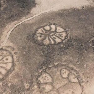
Plato’s own description only deepened the intrigue. He wrote that Atlantis was ringed — concentric circles of land and water, one inside the next, like a target seen from above.

The Detail That Changes Everything
In 1958, a history professor named Charles Hapgood proposed something radical: that Earth’s entire outer crust could slip over its interior, shifting whole continents toward or away from the poles in a geological blink. He called it Earth Crust Displacement. A land that was temperate, he argued, could be dragged into the polar cold and frozen — its history erased under ice.
The idea drew an unlikely admirer. Albert Einstein read Hapgood’s work and wrote a short preface to his book, calling the concept one that “could be of great importance to everything that is related to the history of the Earth’s surface.” Einstein did not endorse Atlantis. But that a mind like his took the mechanism seriously is a detail the theory’s supporters have never let go of.

The Central Mystery
Put the pieces together the way the theory’s believers do, and a haunting possibility takes shape. A map that seems to show ice-free Antarctica. A description of a ringed island civilization. A mechanism by which a warm, inhabited continent could be shoved to the South Pole and buried. Was Antarctica the Atlantis Plato described — a lost world not sunk beneath the waves, but entombed in ice when the planet’s crust lurched?
The mystery is not really about a single map. It is about a question no one can fully close: how could anyone have charted a coastline that has been invisible under ice for far longer than human history?
Competing Theories
It was ice-free Antarctica, revealed by a crustal shift. Supporters — most prominently the researchers Rand and Rose Flem-Ath — argue the Piri Reis map preserves knowledge from a vanished culture, and that a pole shift around the end of the last Ice Age froze the continent and drowned the memory of it. To them, Atlantis and Antarctica are the same lost world.
It is a distorted map of South America. Most cartographers and historians see no Antarctica at all. The southern land, they argue, is simply the coast of South America bent eastward to fit the parchment — a common distortion in maps of the era. The “matching coastline” is a case of the eye finding patterns it wants to find.
It is a fable that never needed a location. Many classicists hold that Plato’s rings were a literary device, and that searching for Atlantis on any real map — Antarctic or otherwise — misreads a story that was always meant as allegory. Some add that the legend may echo a real Bronze Age catastrophe, such as the eruption of Santorini, rather than a polar continent.
It is worth being clear about where the weight of evidence sits: mainstream geology finds no support for a rapid crustal displacement, and the ice sheets of Antarctica are understood to have covered the continent for millions of years — far too long for any human map to record its bare coast. Radar, satellites, and ice-drilling have revealed buried mountains, valleys and lakes beneath the ice, but never a single artifact of a lost city. The theory endures not because science backs it, but because the coincidences are strange enough to keep people looking.

Why It Still Haunts Us
Maybe that is the real pull of this story. Not that it is likely — but that it sits at the exact seam where an old map, an ancient myth, and a scientist’s stray idea seem, for a moment, to line up. We want the past to be bigger and stranger than the textbooks allow. A ringed city at the bottom of the world, frozen mid-history, is a far more thrilling thought than a copying error on a 16th-century chart.
So when you look at that southern coastline on the Piri Reis map — do you see a lost continent that the Earth itself decided to bury? Or a shape we’ve talked ourselves into seeing?
Sources & further reading: Plato, “Timaeus” and “Critias”; the Piri Reis map (1513), Topkapı Palace Museum, Istanbul; Charles H. Hapgood, “Earth’s Shifting Crust” (1958, preface by Albert Einstein) and “Maps of the Ancient Sea Kings” (1966); Rand & Rose Flem-Ath, “When the Sky Fell: In Search of Atlantis” (1995); scientific reviews of crustal displacement and Antarctic glaciation history (British Antarctic Survey; peer-reviewed geology on the ~34-million-year age of Antarctic ice).